 EMODnet Product Catalogue
Resolution
0.00195313 Arc minute
Type of resources
Available actions
Topics
Keywords
Contact for the resource
Provided by
Years
Formats
Representation types
Scale 1:
Resolution
From
1
-
4
/
4
-
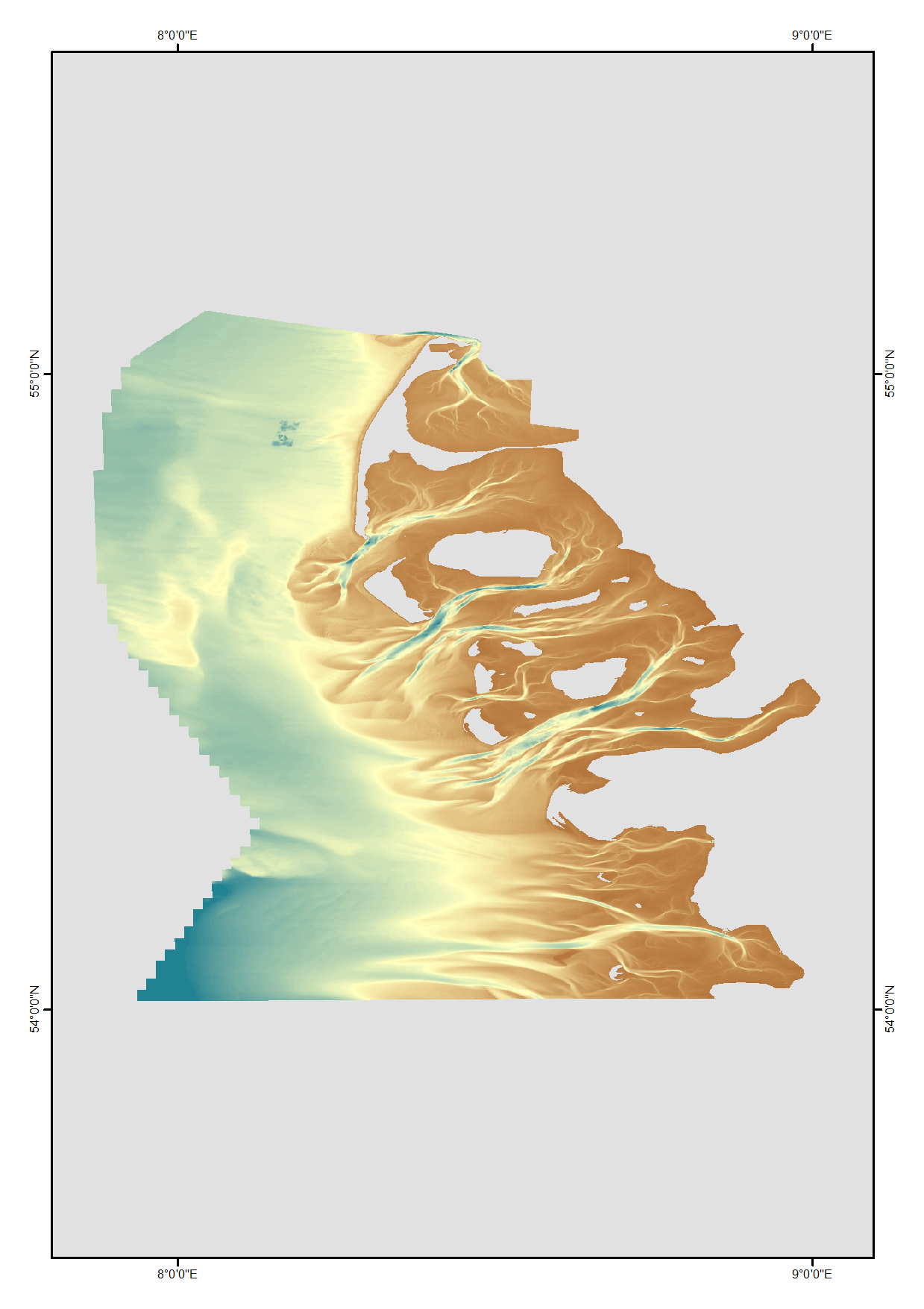
High resolution composite DTM based on single beam, multi beam and Lidar covering Norderney and waters in proximty. All data was acquired in the year 2016. Data used:SDN:CPRD:1850_DGM_Norderney_2016
-
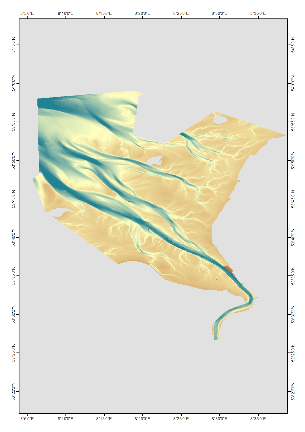
High resolution composite DTM based on single beam, multi beam and Lidar covering the Weser and Weser approach. All data acquired in the years 2010-2017.
-
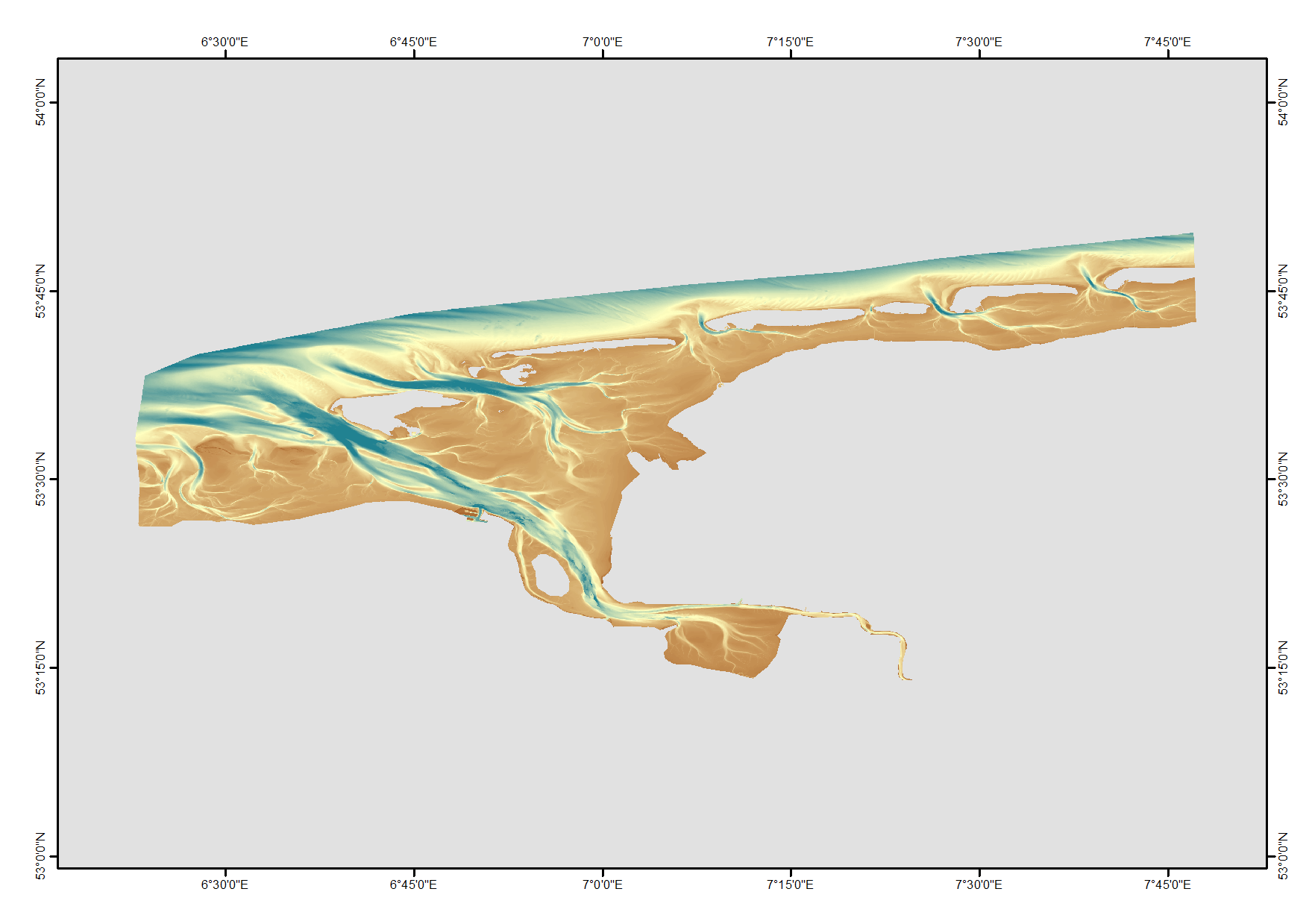
High resolution digital terrain model of the North Frisian waters based on survey data from various sources such as single-beam, multi-beam and Lidar.
-
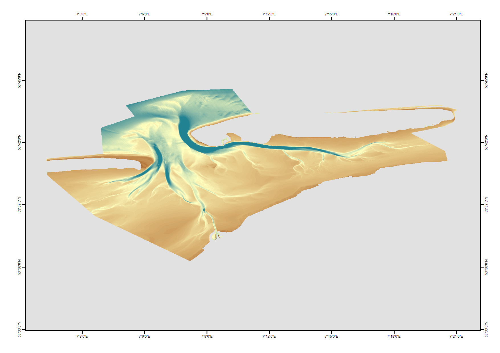
High resolution composite DTM based on single beam, multi beam and Lidar covering the Ems and Ems approach. All data acquired in the years 2012-2015.